


Breaking News
 Christopher Nolan's The Odyssey: Everything to Know About the $250 Million Blockbuster...
 America's Gerontocracy Goes Deeper than Aging Politicians
 The AI Robots Won't Strike, So Hyundai's Workers Did It First
 They've Let the Cat Out of the Bag
Top Tech News
 Modular Reactors To Solve Data Center Hysteria?
 DeepSeek Developing In-House AI Chip In Bid To Cut Nvidia Reliance
 America just took three brand-new nuclear reactors critical in thirty days, a first for any...
 Your brain doesn't peak in your 20s after all: Study reveals your mind is at its sharpest betwee
 Compasses, not maps: China is building a different type of AI
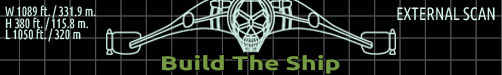
 The Return of the Ekranoplan
 Farewell, atom-smashing Large Hadron Collider
 This is already starting.
 The Crosley IcyBall
 It's Not a Conspiracy Anymore: Med Beds Exist and Trump Knows It


Explore the Red Planet like never before: NASA releases an incredible interactive map...
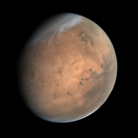
It's the closest planet to Earth, yet humans are still yet to venture the 34.8 million miles to Mars.
Elon Musk recently predicted that humans will first set foot on the Red Planet in 2029, while NASA is a little more conservative with its estimated timeline, predicting a landing in the late 2030s or early 2040s.
Thankfully, there's an easy way to explore Mars now, from the comfort of your home here on Earth.
NASA has released a new interactive map that lets you explore Mars' many cliffsides and craters.
'I wanted something that would be accessible to everyone,' said Jay Dickson, the image processing scientist who led the project. 'Schoolchildren can use this now. My mother, who just turned 78, can use this now. The goal is to lower the barriers for people who are interested in exploring Mars.'
The interactive map of the Red Planet was made at Caltech using 110,000 images snapped by NASA's Mars Reconnaissance Orbiter.
These images cover nearly 270 square feet (25 square metres) of surface per pixel - large enough to cover the Rose Bowl Stadium in Pasadena, California if printed!
The resulting map captures a range of stunning geological features in incredible detail, including cliffsides, impact craters and dust devil tracks.