


Breaking News
 TikToker proposes 'let's buy Spirit Airlines.' Thousands want in
 Lake Mead is in Trouble! Here's What's Happening Now!
 "Lunatic Farmer" Has a GENIUS Idea to Restore Our Farms
 Red Mercury Rabbit Hole...
Top Tech News
 Robot Dives 1.5 Miles, Maps French Shipwreck With 86,000 Images And Recovers Artifacts
 Brain-inspired chip could reduce AI energy use by 70%
 CANCER HAS BEEN CURED
 "This is the first synthetic species," microbiologist J. Craig Venter told 60 Minutes'
 Humanoid robots are hitting the factories at an increasing pace
 Microsoft's $400 Billion Mistake Is Now a $200 Phone With Zero Tracking
 Turn Sand to Stone With Vinegar. Stronger Than Steel. Hidden Since 1627
 This is a bioprinter printing with living human cells in real time
 The remarkable initiative is called The Uncensored Library,...
 Researcher wins 1 bitcoin bounty for 'largest quantum attack' on underlying tech


Take A Tour Of New York City In The 1800s With Google Street View
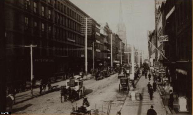
History geeks and time-travelers from the 1800s, get ready to have your days made: Old NYC combines Google Maps with photographs from the New York Public Library to create a timewarped version of Street View.
Developer Dan Vanderkam compiled over 80,000 photos from the NYPL's "Photographic views of New York City, 1870s-1970s" collection and plotted them, using geocoding, to their corresponding origins on an interactive map of the five boroughs.
The creators of the interactive map say its goal is "to help you discover the history behind the places you see every day."